Chinese name: UAV nuclear radiation monitoring
Foreign name: uav enviro nmental monitoring
table of Contents
Introduction
UAV remote sensing technology
·Unmanned aerial vehicle sensor
·Image stitching technology
·Data real-time transmission storage technology
Application of drones in environmental monitoring
·Application of drone in water environment monitoring
·Application of drones in atmospheric environmental monitoring
·Application of drones in ecological environment monitoring
Prospects and development direction
·Strengthen the development of airborne environmental monitoring equipment with miniaturization, light weight and excellent performance
· Strengthen data processing technology research and software development to improve the accuracy and efficiency of data analysis
· Improve data link transmission capability
Introduction
Environmental monitoring is the "sentinel" and "ears and ears" of environmental protection work. It is an important part of environmental management and the most important basic and frontier work of environmental protection work, especially with a series of environmental disasters and environments in recent years. Frequent accidents, the study of environmental monitoring technology has attracted more and more attention from domestic and foreign government scholars. How to obtain accurate, reliable and timely environmental basic data in a convenient, fast and low-cost manner has become the focus and difficulty of technical research.

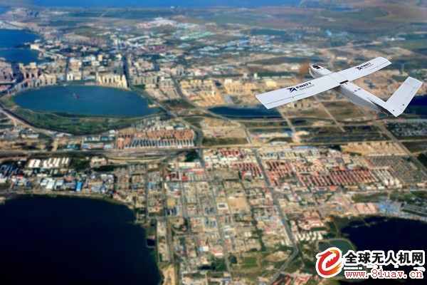
As the third generation remote sensing technology after traditional aviation and aerospace remote sensing, UAV remote sensing technology can quickly acquire spatial remote sensing information such as geography, resources and environment, complete remote sensing data collection, processing and application analysis, and be mobile, economical and safe. Etc.
UAV remote sensing technology
The UAV remote sensing technology is a comprehensive and systematic technical field. The core key technologies include remote sensing sensor, image mosaic technology and real-time data transmission and storage technology.
UAV remote sensing sensor
The sensor is one of the important basic equipment for the development of UAV remote sensing technology. Since the 1980s, with the development of computer technology and the deepening of the application of UAV remote sensing technology in the field of environmental protection, sensors for environmental monitoring have made great progress in terms of digitization, light weight, detection accuracy and types. It has greatly promoted the application of UAV remote sensing technology in the field of environmental monitoring, which is mainly reflected in the following aspects.
1. Aerial image sensor: With the maturity of CCD and CMOS image sensors, the performance of digital cameras is also constantly improving. The resolution of ordinary digital cameras has reached more than 10 million pixels. High-resolution digital cameras have become unmanned. The sensor component of the mainstream low-altitude remote sensing system. In terms of technology, the sensor has been developing in the direction of large area array, multi-spectrum and digitization, and has made more progress, further improving the accuracy of aerial photography.
2. Airborne environmental monitoring sensors: With the continuous development of environmental monitoring instruments and equipment, the development of various airborne special monitoring instruments for miniaturization and light weight monitoring of water environment and atmospheric environment has become an emerging field. From the working mode, the equipment mainly includes spectrum-based equipment based on two-dimensional planar aerial operation mode (such as thermal infrared imager, light infrared aerial scanner, infrared scanner, microwave radiometer, etc.) and pump-based On-board gas monitoring equipment in point sampling monitoring mode (such as particle detector, differential absorption spectrum detection system, electrochemical gas monitoring equipment, etc.).
Image stitching technology
The low-altitude UAV remote sensing platform is used to quickly acquire images of the research area. While the image resolution is improved, the field of view of the single image is small, and it is difficult to form an overall cognition of the large-area environment. Therefore, in order to obtain a panoramic image of the entire area, it is necessary to achieve matching splicing of several images. Influenced by factors such as flight attitude stability, special terrain of flight area, digital camera, etc., remote sensing images of drones often have the characteristics of large rotational deformation, small width, large number, irregular overlay, and difficult ground control points. The aerial photography process is relatively difficult to image stitching, and the speed is slow, although there are
A few scholars have conducted preliminary explorations, but they still need further exploration in terms of accuracy and efficiency. Since the UAVs are mainly used in emergency services such as geological disasters and sudden environmental pollution incidents at present, there are relatively many researches on the rapid splicing processing technology of UAV remote sensing images for environmental emergency, and the adoption process is mainly There are images to be registered and then geometrically corrected.
In the field of environmental emergency monitoring, such as the occurrence of marine oil spill pollution incidents, the rapid splicing technology of large data volume images has important application value in the process of pollution assessment. In particular, the automatic data splicing of massive data supported by no control points or coarse POS data, how to effectively improve the splicing efficiency, and to ensure a certain data accuracy is still one of the current research hotspots.
Data real-time transmission storage technology
The real-time transmission of UAV monitoring data is an important part of the UAV remote sensing system, which determines the scale and level of the system. Data transmission between the ground control station and the drone is achieved through the data link. In addition to the important functions of remote sensing monitoring data transmission, the data link also plays the role of remote control, telemetry and tracking positioning. Most of the early UAV data links are divided into three-dimensional systems. Remote sensing data transmission and remote control, telemetry and tracking are separated by separate channels, and the equipment is complex. After the 1980s, in order to simplify equipment or save spectrum, we began to adopt a multi-functional integrated channel system. Currently, the commonly used channel integration system is a "three-in-one" and "four-in-one" integrated channel system. The so-called "three-in-one" integrated channel system is a unified carrier system for tracking, telemetry and remote control, while the remote sensing monitoring information uses a separate downlink channel. The "four-in-one" integrated channel system refers to the transmission and tracking of remote sensing information. Telemetry and remote control adopt a unified carrier system.
In addition to channel synthesis technology, data compression and decompression technology is also one of the key technologies for remote sensing monitoring information transmission. In the transmission of drone sensor video information, image digital transmission technology has been applied since the 1990s, and it has been used in most UAV measurement and control systems. After the UAV dynamic image compression coding, the image/telemetry composite data rate has been reduced to a minimum of 1~2Mb/s (for example, 11544Mb/s in the US and 212Mb/s in Israel), and the corresponding image resolution can reach 720×576. .
Application of drones in environmental monitoring
Application of UAV in Water Environment Monitoring
Due to the complex environment of inland waters, relatively small water area and various types of pollution, the accuracy of data is high. Therefore, the application of UAV remote sensing technology in inland water environment monitoring is relatively rare, mainly using drones. The environmental remote sensing technology observes the water quality from a macroscopic perspective, and monitors the real-time image data with a resolution of 0.1 m in aerial photography, and tracks and monitors the development of sudden environmental pollution events in real time. The application technology in the ocean is relatively mature, and the monitoring indicators are mainly Covers water temperature, red tide, marine oil spill, water depth, algal bloom, etc. Sensors include cameras, multi-spectral imagers, CCD cameras, light infrared aerial scanners, laser depth sounders, imaging spectrometers, chemical sensors, etc.
Application of UAV in Atmospheric Environment Monitoring
In recent years, domestic research on UAV applications and atmospheric pollutants has just been carried out. Currently, it is mainly used for environmental emergency and simple monitoring of atmospheric environmental indicators. The indicators that can be monitored mainly include ozone, particle concentration, temperature, humidity, NO2 and pressure, such as the Institute of Atmospheric Physics of the Chinese Academy of Sciences, designed two types of micro-UAVs, equipped with improved ozone sensors and particle (number concentration or mass concentration) detectors and temperature and humidity sensors for sounding tests, flight The measurement data is reasonable and credible, and the UAV platform, the recorded sensor and the ground system have reached the design index; the unmanned aircraft platform developed by the Institute of Atmospheric Physics of the Anhui Institute of Optics and Mechanics of the Chinese Academy of Sciences is equipped with a self-developed air pollution differential absorption spectrum detection system. Successfully obtained the two-dimensional spatiotemporal distribution of atmospheric pollutants such as NO2.
Application of UAV in Ecological Environment Monitoring
At present, the application of UAV remote sensing technology in ecological environment monitoring is mainly reflected in disaster monitoring, forest resource survey, and ecological environment. The application method is to use digital cameras or spectrum equipment (such as infrared cameras). , infrared scanners, microwave radiometers, etc.) to obtain remote sensing images, through data splicing and processing, to achieve macro-environmental monitoring or large-scale monitoring indicators (such as land use, vegetation cover, etc.).
(1) For forest resource survey, Sony DSC-90 digital camera can be used as image sensing equipment, combined with geographic information system (GIS) and global positioning system (GPS) technology, and the application of forest resources is investigated in the second category. .
(2) Eco-environmental monitoring and disaster monitoring, high-resolution digital SLR cameras as image acquisition sensors, integrated ground monitoring software, image processing software and radio remote control systems for low-altitude aerial remote sensing systems for ecological environment and disaster monitoring Many fields have important practical significance.
(3) In the aspect of road ecological environment monitoring, the integration of UAV real-time transmission system and remote sensing image processing system, combined with the use of underground electronic identification system to assist in interpreting the land use type, vegetation cover and soil erosion of highway roads The information of the location and change of the elements can build a remote sensing monitoring system for the highway environment and realize the rapid monitoring and investigation of the ecological environment of the highway. The low-altitude flight of the UAV remote sensing system, low cost, flexible maneuverability, and quick response to shooting tasks have great application advantages in the field of ecological environment monitoring, but are limited by high-resolution image processing technology and mission load of the UAV. In terms of limitations, the current application is still in the discussion stage, and there are still few practical business applications.
Prospects and development direction
UAV remote sensing technology, as the third generation of remote sensing technology after aviation and space remote sensing, effectively compensates for the current technical shortcomings of satellite remote sensing and aerial remote sensing, and has the advantages of low price, good security, flexible operation, etc. The further development and the further improvement of people's requirements for environmental monitoring will be more and more extensive in the field of environmental monitoring.
Strengthening research and development of airborne environmental monitoring equipment that is miniaturized, lightweight, and excellent in performance
China's UAV remote sensing technology is still in the early stage of development in the field of environmental monitoring. Due to load and space constraints, most of the traditional environmental monitoring sensors can not meet the system requirements, and most of the equipment currently used, such as high-quality analyzers, special Monitoring instruments and automatic monitoring systems are mostly imported from abroad and are expensive. Therefore, China needs to strengthen the research and development of airborne environmental monitoring equipment with small size, light weight, high precision, large storage capacity and excellent performance, that is, in existing environmental monitoring. On the basis of equipment, the weight and volume are reduced, and the functional density is increased. The measures that can be taken include: 1 using high-strength lightweight materials to reduce the volume and weight of the sensor components; 2 improving internal layout, improving integration, and expanding the mission capability of the drone; 3 developing scalability and measurement and control capabilities monitoring equipment, such as a line capable of continuous automatic monitoring system for multiple quality (air, water, noise) and automatic monitoring system of sewage, exhaust, pollution emissions of major pollutants; â‘£ integrated variety of new technologies to improve performance. In addition, the remote sensing technology for UAVs in the field of environmental monitoring such as the atmosphere and water is still in its infancy, and sensors for monitoring many indicators need to be further developed. Technically, in the context of miniaturization, light weight, and integration of equipment, infrared and ultraviolet remote sensing telemetry instruments and long-range absorption spectrometers (laser radars) based on laser light source can be developed for use in cities. High-temporal resolution detection of atmospheric environment and urban pollution sources; development of portable emergency monitoring equipment for on-site pollution accidents.

Strengthen data processing technology research and software development to improve the accuracy and efficiency of data analysis
UAV systems have their own special characteristics in the data acquisition process, such as low-altitude flight, unstable attitude, and low attitude parameters. The applicability of traditional aeronautical data processing methods in the data processing process of drones is often relatively poor. The data processing technology and software development for the characteristics of UAV systems are developed to improve the accuracy and automation of data analysis. One of the important means of application in the field of environmental monitoring. For example, for remote sensing image data of drones, research on image matching and correction techniques without control points and posture parameters should be strengthened, and relevant software should be developed to improve the accuracy and efficiency of image data processing; and for other environmental monitoring index data, How to integrate with the ground monitoring indicators to achieve integrated application of open space integrated data is also an important direction for the development of UAV remote sensing technology.
Improve data link transmission capability
With the increase of the airborne capacity and data accuracy requirements of the drone, the data transmission capacity has higher requirements in terms of data transmission rate, anti-interference ability and range. The technical difficulties of the UAV data link system are mainly reflected in the semi-physical simulation of the wireless transmission environment, the adaptive digital down conversion technology based on software radio, the anti-jamming system of asymmetric modulation, and the graphical programming language Agilent VEE and network environment. The microwave instrument features integration and remote control technology. In addition to strengthening the above-mentioned key technical difficulties, the generalization, serialization and modularization of the data link are also one of the important development trends of the mainstream of domestic and foreign UAV systems. Therefore, the preparation of relevant standards and norms should be strengthened in the future.
As a potential environmental monitoring technology, UAV aerial remote sensing has developed rapidly in the past few decades. At present, China has proposed the concept of establishing an integrated environmental monitoring network system for “skyâ€. The research on the environmental monitoring fields of the UAV in the atmosphere, ocean, water, geological disasters and ecology has begun. Machine platform technology, environmental sensor technology, and environmental remote sensing technology continue to mature. The environmental monitoring system based on UAV remote sensing technology will play an increasingly important role in environmental monitoring with its many difficult advantages.
EXPLOSION WELDING IN FABRICATION PROCESS
1. Preparation of the metal materials of the cover plate and the base plate (including surface purification treatment);
2. Explosives, cartridges, interstitial objects and protective layer preparation;
3.Process installation on sandy soil foundation;
4.Explosive welding using electric detonator detonation method;
5.Inspection of the surface and appearance quality of the composite board;
6.Non-destructive testing NDT (UT, PT);
7.Destructive organization and performance inspection to determine the quality of the combination;
8. Processing and shaping such as leveling, shearing or turning (heat treatment as required);
9.Factory inspection: inspection of appearance, surface and size, marking and coding;
10.Packaging and leaving the factory;
Our product incluse: Clad Plates; Electrical Transition Joints; Conducting Materials for New Energy; Structural Transition Joints; Cryogenic Transition Joints; Clad Pipes.
Clad Plates; Electrical Transition Joints; Conducting Materials for New Energy; Structural Transition Joints; Cryogenic Transition Joints; Clad Pipes.
Changshu Herun Import & Export Co.,Ltd , https://www.herunchina.com